Guide to San Francisco Bay Area Creeks
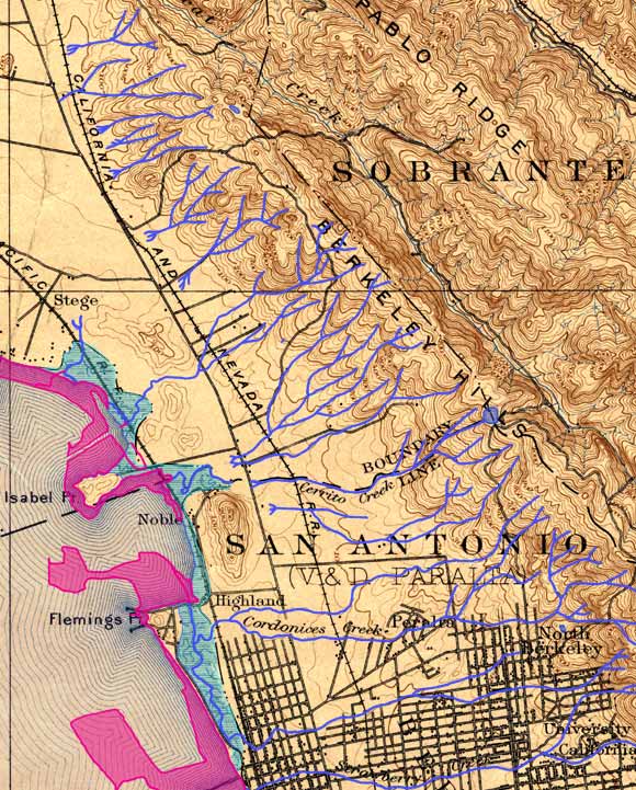
Baxter Creek - Schoolhouse Creek Topo, 1899
Blue lines emphasize creeks as mapped in 1899, green tint emphasizes marshes,
Magenta tint is modern fill areas
Most of the creeks flowing off the west-facing slopes of the Berkeley Hills
were intermittent, meaning dry in the summer. Except during floods, most of the
streams on this map did not flow all the way to San Francisco Bay. Their flows
percolated into the sandy soils at the base of the hills. The creeks at the northernmost
part of this map were directed into a flood-control channel, running through Stege,
forming Baxter Creek. South of that, a creek did have a natural channel flowing
all the way to the bay, but it never got a name. We refer to it as Fluvius Innominatus.
South of that, many creeklets flowed into Cerrito Creek, the largest creek of
the region, and the county line.
Click image for information on specific watersheds
USGS Topographic Map: Concord, Calif. 1/62,500,
1897; Courtesy of HISTOPO
|