Guide to San Francisco Bay Area CreeksSEAL CREEK WATERSHEDThe original channel that is now Marina LagoonBetween the towns of San Mateo and Belmont, a series of short, intermittent streams drained the east slope of the Peninsula. During all but the heaviest rains, their water soaked in to the ground before reaching the bay, probably reemerging at the edge of the salt marsh. In those days, the tidal sloughs of the salt marshes were named as "creeks" independent of any freshwater stream draining an upland that we would think of as a "creek" today. Laurel Creek and the streams to the south would have drained into the O'Neill Creek/Angelo Creek system. To the north of Laurel creek, the streams drained into Seal Creek. The map below shows how the area looked in 1914. Today, Foster City is on top of the marshes on the eastern portion of this map. Seal Creek, and portions of Angelo Creek are what are today known as Marina Lagoon. Animated transformation from Seal Creek to Foster City (3.6mb)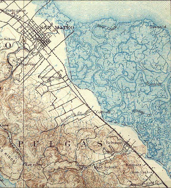 USGS Topographic Map: San Mateo, Calif. 1/62,500, June 1915
|