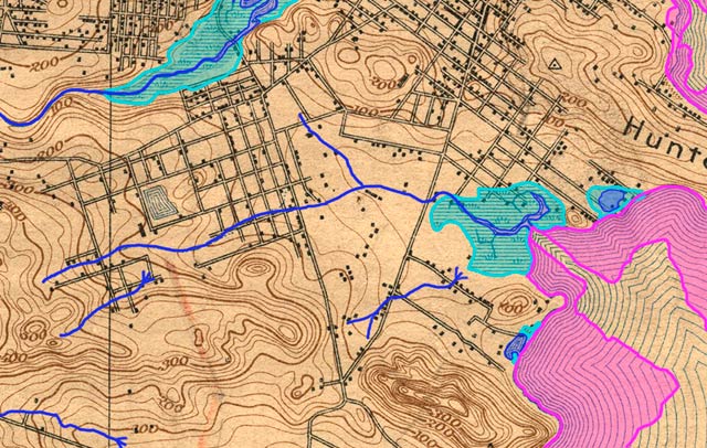
Guide to San Francisco Bay Area CreeksYosemite Creek, 1896Topographic map from the 1890s with original creeks in blue, marshes in green, and modern land fill in pink
USGS Topographic Map: San Mateo, Calif. 1/62,500, 1896; Courtesy of HISTOPO; Revised2008
|