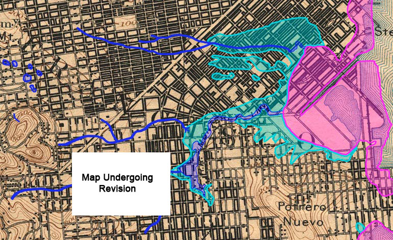
Guide to San Francisco Bay Area CreeksMission CreekTopographic map from the 1890s with original creeks in blue, marshes in green, and modern land fill in pinkThe street grid shown on this map is from the 1890s. Market street runs diagonally across the upper left; Mission Bay had already been filled in as far east as Third Street. The network of creeks in the mid to lower left is Mission Creek. The large marsh in the upper middle is part of Hayes Creek. Hayes Creek started in Hayes Valley then sank below the sand dunes underneath what is now City Hall and Market street.
USGS Topographic Map: San Francisco, Calif. 1/62,500, 1895; Courtesy of HISTOPO; Revised2008
|