Guide to San Francisco Bay Area Creeks
North Beach Watersheds
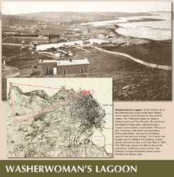
Before extensive landfill, Telegraph Hill drained directly into the bay on three sides; to the southwest, runoff flowed to Yerba Buena Cove. The bayward slopes of Russian Hill and Pacific Heights drained to Cow Hollow
in small rills running to a series of ponds impounded behind the dunes at Fort Mason. Washerwoman's Lagoon was one such pond.
Portion of Creek & Watershed Map of San Francisco & Vicinity -- Purchase Printed Map
Watershed maps, click to enlarge
|
|
|
|
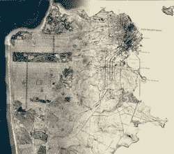
San Francisco, circa 1860 |
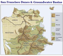
Geology & Groundwater Basins |
Washerwoman's Lagoon |
|
|
|
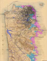
Historical San Francisco Peninsula |
San Francisco 1869-2007 |
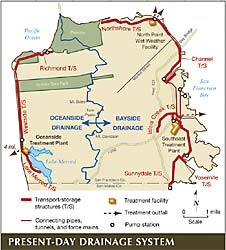
Present-Day Drainage Systems |
|
 for point of interest