Guide to San Francisco Bay Area Creeks
San Francisco Dunes, Northwest
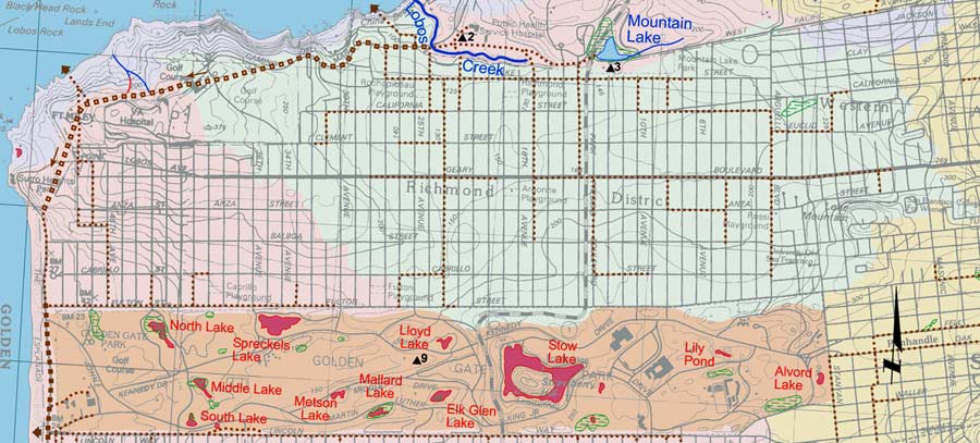
One of the best locations to view remains of the once-vast dune fields of western San Francisco is on the north bank of Lobos Creek, designated as Point of Interest 2 on this
map. There is little of the sand-dune plant community left in Golden Gate Park, but hydrologically it functions much as it always has. There are no stormdrains; rainfall simply soaks
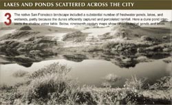
into the sandy soil. Many of the lakes today are remnants of the naturally occurring lakes, where topographic low spots intersected the water table.
Portion of Creek & Watershed Map of San Francisco & Vicinity -- Purchase Printed Map
Watershed maps, click to enlarge
|
|
|
|
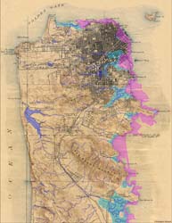
San Francisco, circa 1860 |
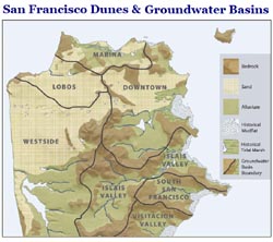
Geology & Groundwater Basins |
Lakes and Ponds |
|
|
|
Historical San Francisco Peninsula |
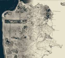
San Francisco 1869-2007 |
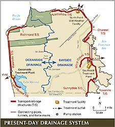
Present-Day Drainage Systems |
|
 for point of interest