Guide to San Francisco Bay Area Creeks
Edgemar & Laguna Alta Watersheds
The Edgemar & Laguna Alta Watersheds include:
No named tributaries
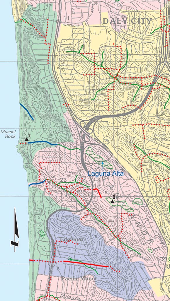
On Steep sea bluffs, runoff flows straight downhill to the beach, and the concept of a watershed becomes a little ill defined. The green area on the
west side of this map is one such area. The pink area is the current watershed for stormdrain network draining at the end of Skyline Drive. This network has captured the drainage
from the Laguna Alta, which originally flowed to a point just north of Mussel Rock. Laguna Alta and the other ponds shown here in green were sag ponds on the San Andreas Fault until
they were drained and filled. However, at the head of this watershed, new ponds continue to form.
|