Guide to San Francisco Bay Area Creeks
Creek & Watershed Map of
South San Jose
Find your neighborhood creek, and learn about your watershed
Creek & Watershed Map of South San Jose. The printed version of this map presents both the historical and modern hydroscapes of the area from Los Gatos through Santa
Teresa to Coyote Valley, with emphasis on the southern Guadalupe River subwatersheds.
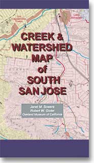 |
Watersheds shown include:
- Ross Creek
- Guadalupe Creek
- Alamitos Creek
- Canoas Creek
- Coyote Creek
Features include:
- Guadalupe River Stewardship
- Taming an Urban Stream
- Legacy of the Mercury Mines
|
|