Guide to San Francisco Bay Area Creeks
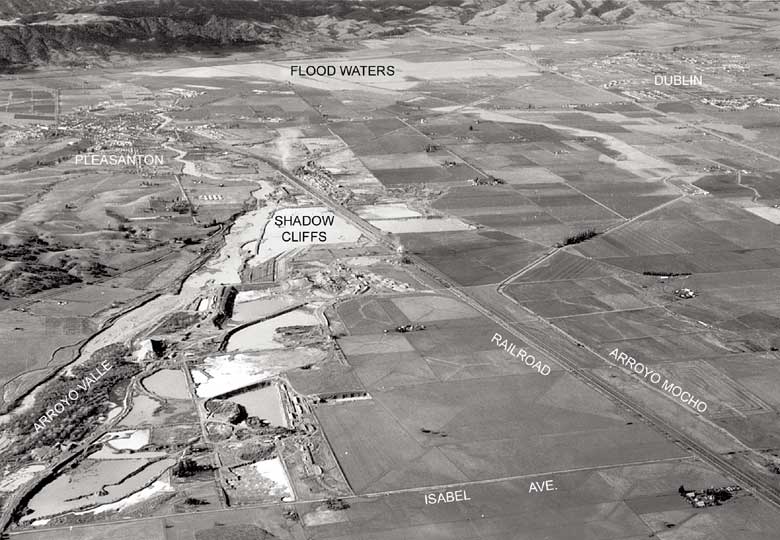
Pleasanton Flood, 1955
An event that stimulated a major flood-control project.
|

Photo Courtesy of Zone 7 Water Agency
|
This photo was taken December 24, 1955, the day after the peak flows of the
record flood in the Alameda Creek Watershed. Arroyo Valle and the Shadow
Cliffs Quarries are in the foreground to the left. Tulare Lake had been
drained around 1907, but in this flood, it reappeared in the background of
this photograph. It is striking how little development took place in
Pleasanton before 1955, compared to the second half of the century.
|
