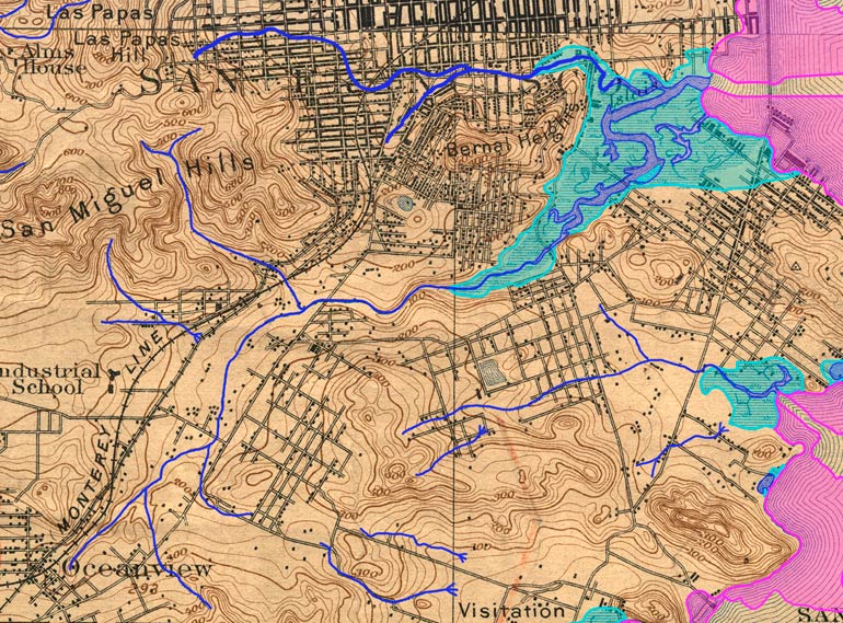
Guide to San Francisco Bay Area CreeksISLAIS CREEK, 1896Topographic map from the 1890s with original creeks in blue, marshes in green, and modern land fill in pinkThe modern channel of Islais Creek is in an area of fill that had been open bay. What you see here as the creek has been completely put in a culvert and paved over.
USGS Topographic Map: San Mateo, Calif. 1/62,500, 1896; Courtesy of HISTOPO; Revised2008
|