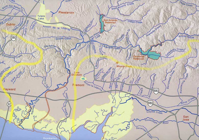
This is the southern portion of the larger map Creeks of the East Bay,
a regional map showing creeks from Martinez to Morgan Hill and Altamont Pass to
San Francisco Bay. Highlighted in yellow is a portion of the Alameda Creek watershed.
This is about one-half of the total area of this watershed.