Guide to San Francisco Bay Area Creeks
Arroyo de la Laguna
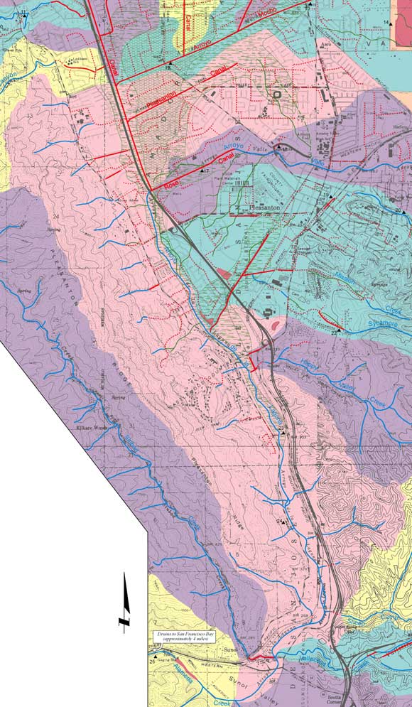
Watershed Map
The Arroyo de la Laguna Watershed is the pink area
in the middle of the map. Sinbad Creek is the watershed to the west, shown in
purple.
The heart of the Amador
Valley used to be Tulare Lake, a large, shallow lake, fed by creeks, springs and
seeps, and largely overgrown with tules and willows. (It is indicated on the map
by the green marsh-stipple pattern.) Whether by creek flows or seeping groundwater,
this lake received all the runoff of the Amador Valley and the huge watersheds
of Arroyo Mocho and Arroyo Valle, stretching far to the south. This lake drained
the short distance to its confluence with Alameda Creek, near Sunol, via Arroyo
de la Laguna. Thus while the immediate watershed of this short creek is correspondingly
small, confusingly, the name Arroyo de la Laguna Watershed can also be applied
to the entire region it drains - the Amador Valley including Arroyos Mocho and
Valle.
Portion of Creek & Watershed Map of the Pleasanton & Dublin Area -- Purchase Printed Map
|