Guide to San Francisco Bay Area Creeks
Arroyo de la Laguna
Portion of Alameda Creek Watershed
Two major tributaries combine to form the main stem of Alameda Creek. These tributaries are Arroyo de la Laguna and South Fork Alameda Creek.Of course, each of these two tributary streams are in turn fed by many smaller tributaries. This page has links to high-resolution maps of the creeks of the northern end of the Arroyo de la Laguna watershed, around the cities of Pleasanton and Dublin. Tributaries on the eastern and southern ends of this watershed are only represented on a low-resolution, regional map.
The creeks in this region include:
Alamo Creek, Arroyo de la Laguna, Arroyo Las
Positas, Arroyo Mocho, Arroyo Valle, Chabot
Creek, Clark Canyon, Collier Creek, Cottonwood
Creek, Dublin Creek, Gold Creek, Happy Valley
Creek, Koopman Canyon, Kottinger Creek, Martin
Canyon, Mission Creek, Oak Creek, Pleasanton
Canal, San Ramon Creek, Sheep Camp Creek, Sinbad
Creek, Sycamore Creek, Tassajara Creek, Tehan
Canyon, Vallecitos Creek.
or click on the individual maps in the array below. |

|
This array of map thumbnails in approximate geographic relationship |
||
 |
 |
 |
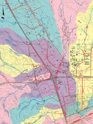
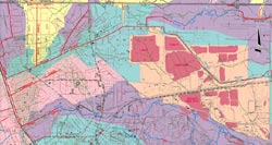
Alamo Creek |
Tassajara Creek |
Arroyo Las Positas, Lower |
 |
 |
|
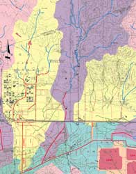
Arroyo Mocho, Lower |
||
 |
||
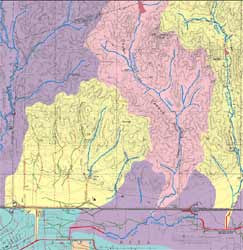
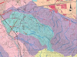
Arroyo de la Laguna |
Arroyo Valle |
|
 |
||
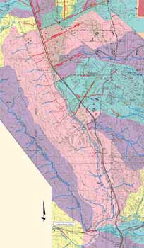
Upper Alameda Creek |
||
Top of PageAlameda Creek WatershedsGlossary |