Guide to San Francisco Bay Area Creeks
Arroyo Mocho
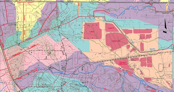
Watershed Map
This map only shows the northern portion of this watershed.
The Arroyo Mocho Watershed is indicated here in green. The large orange
area with the pink lakes is an area used as a ground water recharge basin. Water
from Arroyo Mocho is released into these ponds, but no surface water flows out
of the area, so it is not part of the Arroyo Mocho Watershed. Arroyo Mocho flows
through this basin but is separated from it by high levees.
Portion of Creek & Watershed Map of the Pleasanton & Dublin Area -- Purchase Printed Map
|