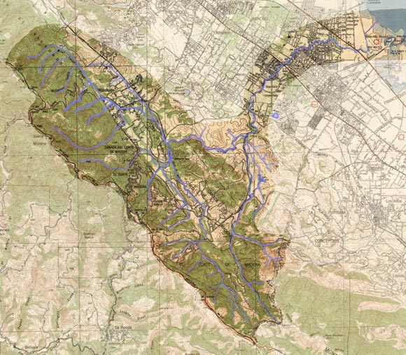
Guide to San Francisco Bay Area CreeksSan Francisquito Watershed, 1940This representation of San Francisquito Creek from the 1940s is largely accurate for today other than the alteration of the creek mouth. Watershed boundary is only approximate, particularly in the flatlands.
|
Top of PageSan Francisquito Watershed InformationGlossary |