GUIDE TO EAST BAY CREEKS
Chapter Twelve
San Leandro Creek Tour
The driving part of this tour is 20 miles, from Park Boulevard and Highway 13 in Montclair to the intersection of Estudillo and I-580. The suggested walks are all on easy, smooth terrain. If you like to explore off the beaten path, wear hiking shoes and protective clothing (ticks and poison oak!).
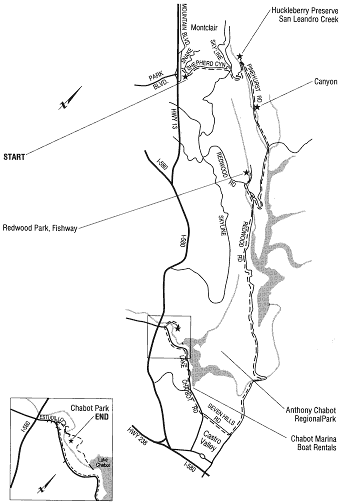
Fresh from the goldfields, Anthony Chabot turned his hydraulic mining hoses onto a hill behind San Leandro, washing it down to block the creek. He ran wild mustangs across the dirt, compacting it into a dam, and put crews of Chinese laborers to work building pipelines to deliver this new gold, water, to the growing communities of the East Bay. The year was 1879. Creation of Lake Chabot trapped the migrating steelhead forever in the upper reaches of San Leandro Creek. Below the dam, the watercourse — once navigable from the Bay to East 14th Street — was turned into a sodden dribble.
From Park Boulevard and Highway 13, go north on Mountain Boulevard to Snake Road, and turn right. Follow the double yellow line; it will lead you along Shepherd Canyon Road, which twists and turns up the hill. Cross Skyline Boulevard, and go down Pinehurst Road. You'll meet the creek near the bottom.
There is a gate at the hairpin turn. Park there and walk up the fire road alongside San Leandro Creek. You will soon be in a seemingly different world; the Bay Area disappears completely in the oak and bay of the creek canyon. About 100 yards upstream, a wide flat spot of land on the left is encircled by a bend in the creek. In the wet spring of 1993 there was a fine-looking sequence of pools and riffles along here, although they were too sand choked for trout to spawn.
Continue walking up the main branch of the creek. You'll see an upended metal pipe with a locked box on top and a stick gauge in the creekbed, where EBMUD scientists monitor stream flow. Across the road is a wellhead and wiring for a pump, more signs of previous occupation, including the non-native forget-me-nots and periwinkle covering the ground.
There is wonderful creek access along here. Old, mossy bay trees with hollow trunks line the banks, like something out of a fairy tale. The long white alders reach, rainforest-style, from the canyon to sunlight. The fire road soon meets the East Bay Skyline National Trail, connecting a string of East Bay Regional Parks.
Returning to your car, continue on Pinehurst Road, following the creek south. An abandoned railroad line runs above the road — once part of the Sacramento Northern Railroad Company lines running from Oakland through a tunnel from Shepherd Canyon and on to Sacramento. A bit further on is the little community of Canyon, once a summer resort on the rail line.
Park at the Canyon Post Office and walk back to where the creek meanders gently, depositing gravel on alternating sides of the stream. Then walk back downstream. You can see the major efforts to stabilize the banks and prevent undercutting of the highway and the land around the new school. From the rustic bridge into Canyon itself, a concrete stabilizing wall looks like a castle moat. Graffiti artists in this damp community carve their work into the wall's green moss!
Continue downstream on Pinehurst Road. At the intersection of Canyon Road, bear right toward Hayward. The creek widens into Upper San Leandro Reservoir, the result of a second dam. Where Pinehurst ends at Redwood Road, turn right, go 500 yards, and turn right again into Redwood Regional Park. Drive 100 yards beyond the guardhouse, turn left, and park in the first lot.
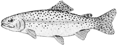
Following the sign, walk to the fishway. This step-like structure was built to enable fish to reach spawning areas upstream. Interpretive signs tell about the rare rainbow trout trapped behind the dams. (See "Local Fish Makes Good" following this chapter.) Despite people's well-intended efforts, fish do not always behave as expected. During the spawning season in 1993, local trout ignored the fishway and migrated up a stream to the west. Fish experts think this is because the gravel in the creekbed was embedded in silt due to erosion, making it hard for the females to dig nests. One wonders how the fish could know!
Further into the park, Stream Trail follows Redwood Creek into a redwood forest — a continuation of the San Antonio Forest, which stretches to Oakland's Dimond Canyon (see "Sausal Creek Walk" p. 26). In 1860, these hills were completely bare. Regrowing from the stumps loggers left behind, today's magnificent, tall trees are the State's oldest second-growth timber stand.
Leaving the park, turn left on Redwood Road and continue south along the "back side" of Oakland. Redwood Creek soon widens into another arm of the Upper San Leandro Reservoir. Continue driving south on Redwood Road past the Anthony Chabot Park Marciel Gate.
At the Willow Park Golf Course, the creek curves to the west, widening into Lake Chabot. At the first stoplight, Seven Hills Road, turn right. Proceed to the next stoplight, Lake Chabot Road, and turn right. Continue past the Lake Chabot Marina. Then, bearing right on Lake Chabot Road, proceed to Estudillo. Here, turn right and go to Chabot Park.
San Leandro Creek flows east under the entrance bridge before it jogs back to its westerly course through the flatlands. It runs along the west and south edges of the park, easily accessible from a large picnic area. It is a fun place to look for creek critters and plants.
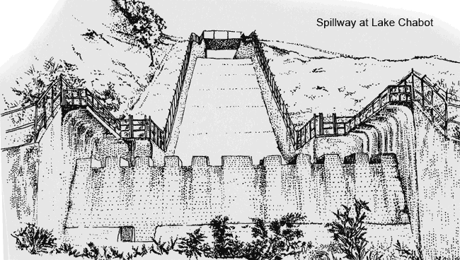
Lake Chabot is still a source of water for the East Bay. There is a filter plant to the left as you come in the park. You can hike up the hill on West Shore Trail to the top of Anthony Chabot's earthen dam. The dirt road that follows the creek to the bottom of the dam spillway is a restricted area. It is the site of the camp for Chinese laborers who worked on the original dam.
Today, huge eucalyptus trees mark the open, concrete-box course of San Leandro Creek as it makes its way across town to San Leandro Bay. Creek consciousness is rising in San Leandro. At East 14th Street and Davis, the historic heart of town, a plan has been adopted that will incorporate San Leandro Creek into tiny Root Park with a series of cantilevered observation decks and stairs. A creekside walk and amphitheater are planned further west. San Leandro Creek meanders through industrial areas into Oakland at 98th Avenue. Here it widens spectacularly, giving a sense of the navigable creek that was a spawning route for salmon and trout. At Hegenberger Road, the creek enters the Bay at the Martin Luther King, Jr. Regional Shoreline near Arrowhead Marsh.
-- Shelby Hall
Chapter 11 Chapter 13 |
Top of PageTable of ContentsGlossary |