Guide to San Francisco Bay Area Creeks
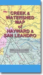
Creek & Watershed Map of
Hayward & San Leandro
Find your neighborhood creek, and learn about your watershed
Creek & Watershed Map of Hayward & San Leandro. The printed
version of this map presents both the historical and modern hydroscapes of central
Alameda County, including past and present creeks, marshes and shorelines.

 |
Watersheds shown are:
- Elmhurst Creek, partial
- San Leandro Creek
- Oyster Bay Watersheds
- Estudillo Canal
- San Lorenzo Creek
- Bockman Canal
- Sulphur Creek
- Hayward Landing
- Johnson Landing
- Mt. Eden Creek
- Alameda Creek, partial
Also Featured are:
|
Limited number of Hayward & San Leandro creek maps are available direct from the Museum Store.
Call for availability. 510 238-6305
Available for Download (63 meg)
- By: Janet M. Sowers
- Published By: The Oakland Museum of California, 1996
- Funded By: Alameda Countywide Clean Water Program, City of Oakland.
- Distributed By: Oakland Museum Store,
Oakland, CA
- ISBN: 1-882140-12-5
|