Guide to San Francisco Bay Area Creeks
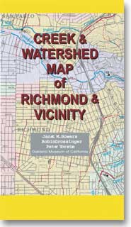
Creek & Watershed Map of
Richmond & Vicinity
Find your neighborhood creek, and learn about your watershed
Creek & Watershed Map of Richmond & Vicinity. The printed version of this map presents both the historical and modern hydroscapes of the area from Rodeo through
Richmond to El Cerrito, with emphasis on the western portions of the numerous watersheds.
 |
Watersheds shown include:
Features include:
- Wildcat Watershed Landscape Change
- Baxter Creek Waterscape Change
- West Contra Costa Watersheds
|
|