Guide to San Francisco Bay Area Creeks
Guadalupe Slough Watershed
The Guadalupe Slough Watershed includes:
Saratoga Creek, San Tomas Aquino Creek, Smith Creek, Wildcat Creek, Booker Creek, Calabazas Creek, Rodeo Creek, Sunnyvale East Channel, Sunnyvale West Channel.
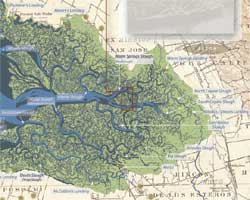
The Primeval mouth of the Guadalupe River was Guadalupe Slough, to the east lay Alviso (Steamboat) Slough. Alviso Slough was not fed by any upland streams, but simply carried tidewater in and out of the extensive salt marshes. Alviso Slough was relatively straight, while Guadalupe Slough meandered extensively through the marshes. To make it easier to get sailboats up the Guadalupe River to the port of Alviso, the Guadalupe River was redirected into the straighter Alviso Slough by the 1870s.
Historically the creeks that now drain into Guadalupe Slough did not reach all the way to San Francisco Bay; they are now connected to Guadalupe Slough by a network of flood-control channels.
|
|
 |
 |
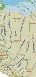
Guadalupe Slough Watershed Map |
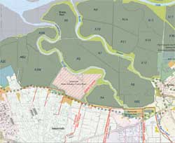
Guadalupe Slough Baylands Map |
 |
 |
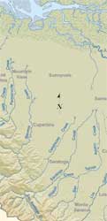
Historical Watershed Map |
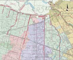
Lower Guadalupe Slough Watershed Map |
 |
 |
Historical Baylands Map |
Middle Guadalupe Slough Watershed Map |
Top of PageWest Valley WatershedsGlossary |