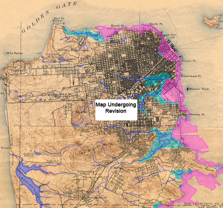
Guide to San Francisco Bay Area CreeksSan FranciscoTopographic map from the 1890s with original creeks in blue, marshes in green, and modern land fill in pink The street grid shown on this map is from the 1890s. Note the lack of creeks in the Richmond, Sunset, Western Addition, and Financial District. These areas were covered with sand dunes. Because of the permeable soils, rainwater soaked-in immediately. Yes, these areas are watersheds, but the water flowed away in underground aquifers. Today, when heavy storms raise the water levels of the aquifers, they flood into many people�s basements.
USGS Topographic Map: San Francisco, Calif. 1/62,500, 1895; Courtesy of HISTOPO; Revised2008
|