Guide to San Francisco Bay Area Creeks
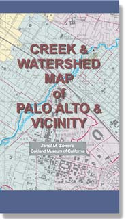
Creek & Watershed Map of
Palo Alto & Vicinity
Find your neighborhood creek, and learn about your watershed
Creek & Watershed Map of Palo Alto & Vicinity. The printed version
of this map presents both the historical and modern hydroscapes of the area from
Redwood City through Palo Alto to Mountain View with emphasis on the San Francisquito
Creek Watershed
|
Watersheds shown include:
Features include:
|
- By: Janet M. Sowers
- Published By: Oakland Museum of California, 2005.
- Funded By: CALFED, San Francisquito Watershed Council, Silicon Valley Pollution Prevention Center,
cities of Mountain View & Palo Alto, William Lettis & Assoc., Oakland Museum of California, and Santa Clara Valley Water District.
- Distributed By: Oakland Museum Store,
Oakland, CA
- ISBN: 1-882140-25-7
- Price: $6.50
- PURCHASING INFORMATION
|